ArchGIS Research
Using ArchGIS to research and propose new greenway connections and areas of opportunity to improve pedestrian focus.
Location: The Gulch, Nashville, TN
Date: Summer 2025
Professor: Clay Adkisson, Will Rosenthal, Harriett Brooks, & Adam Nicholson
Peers: Audrey Reddick
Greenway Additions
By analyzing nearby park spaces and vacant lots, we identified potential greenway routes within a 10-minute walk, enhancing connectivity and accessibility between The Gulch and surrounding neighborhoods.
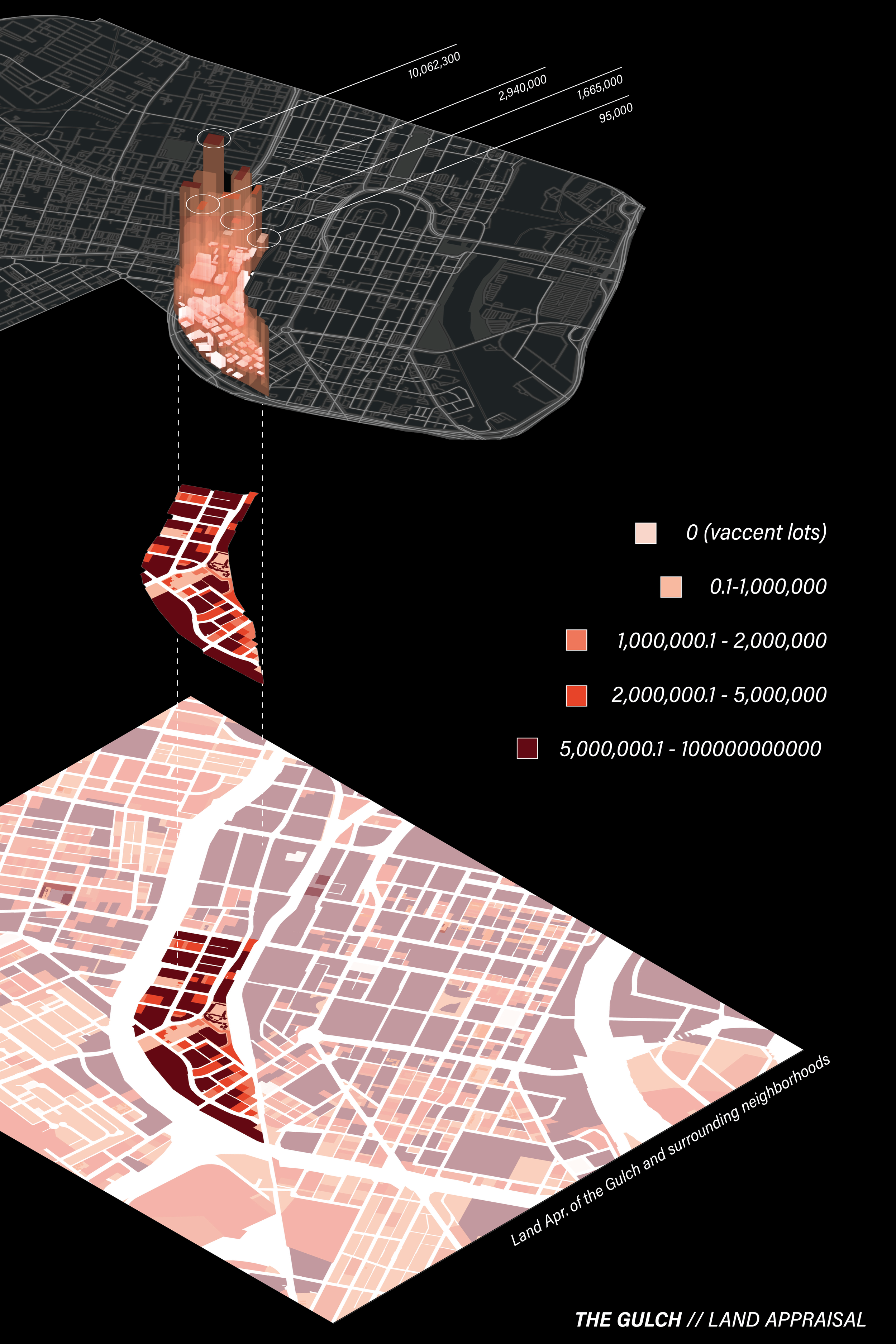
Land Value
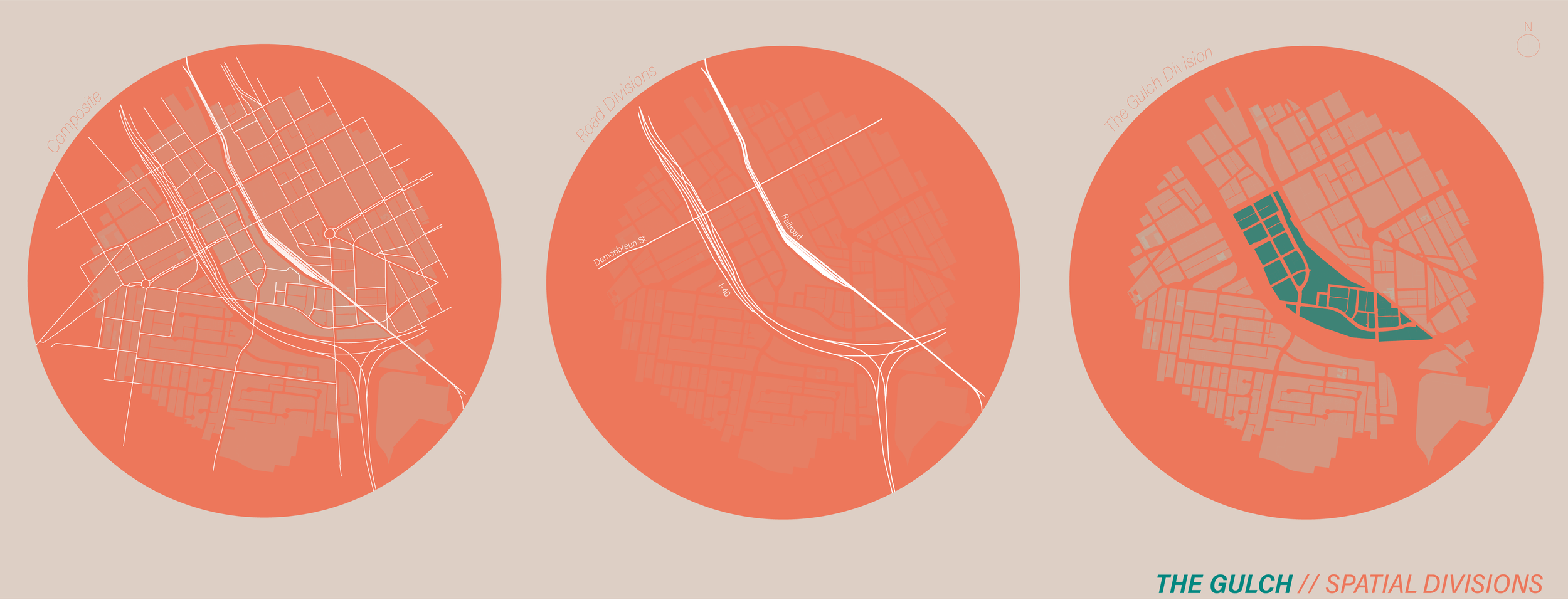
This research proposes new greenway connections that address fragementation caused by 1-40, the railroad, and Demonbreun Street.
Due to high land appraisals, creating green spaces in The Gulch is challenging.
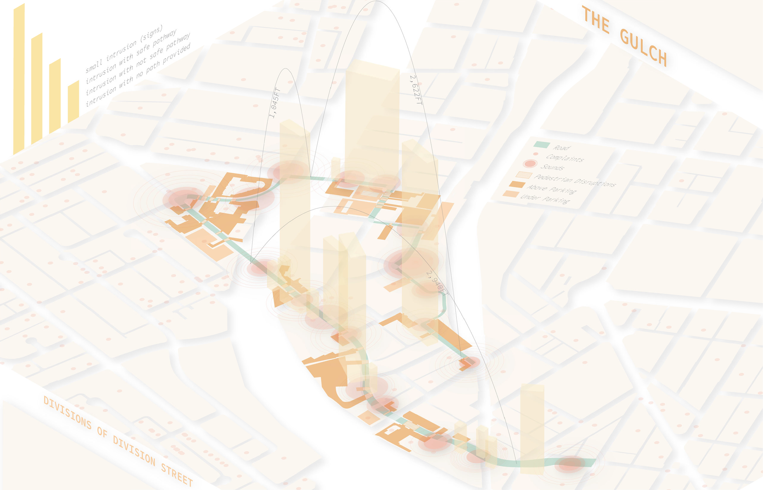
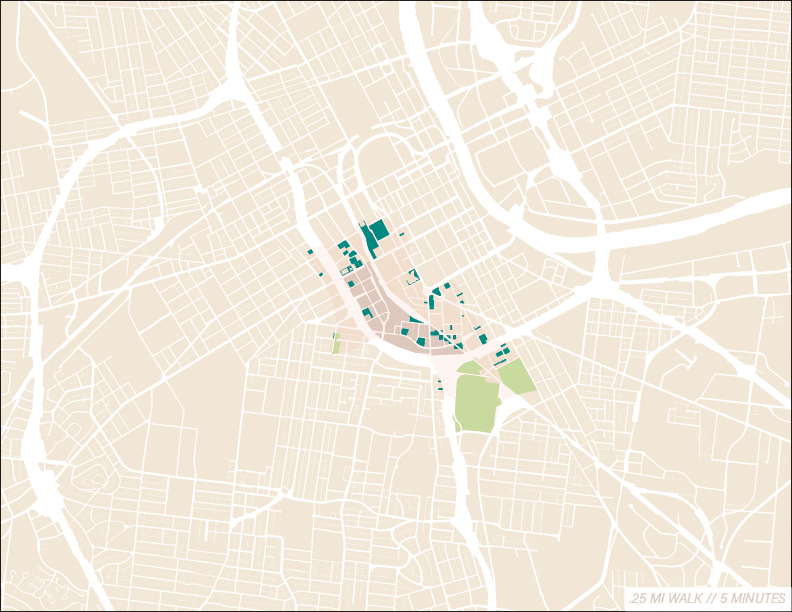
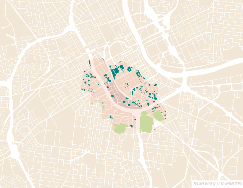
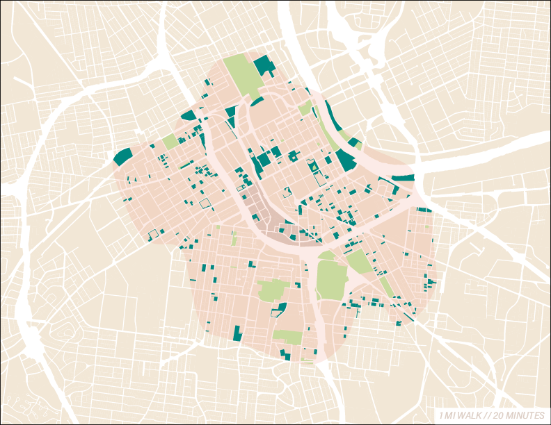
Walkability

Greenway Proposals
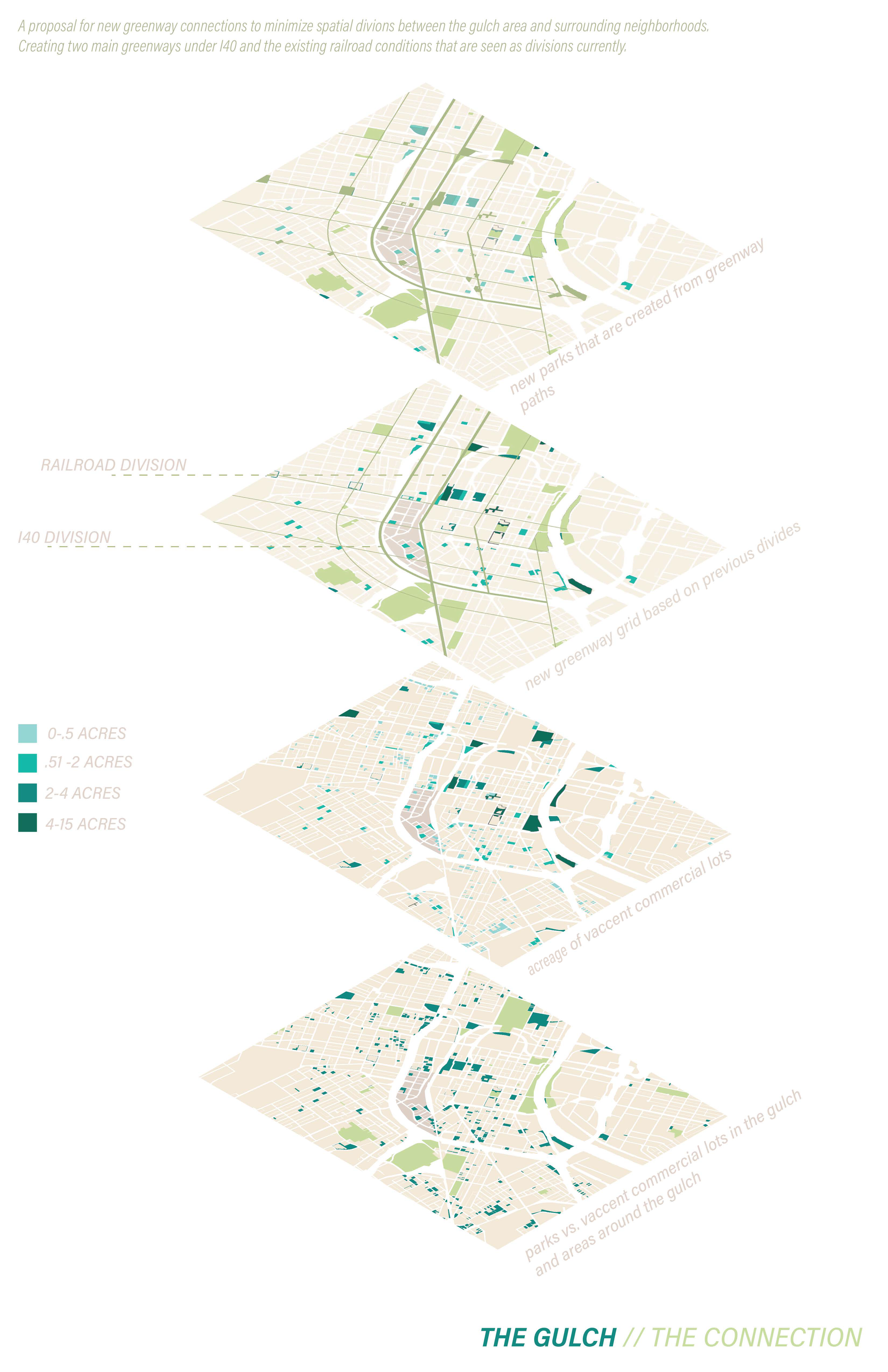
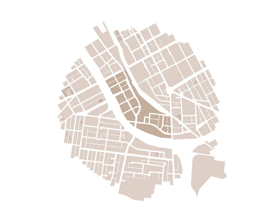
The Gulch - Divisons
Through GIS research and site investigations, we identified that The Gulch’s urban design is heavily car-focused.
In the ArchGIS research shown on the right, proposals are created for existing parking areas, which currently hinder pedestrian experiences, to be seen instead as opportunities for future development.
This shift has the opportunity to enhance walkability and improve the pedestrian experience in the area.